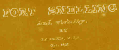
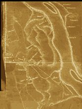
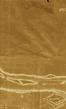
| This important map, unmatched in its detail and coverage of the Camp Coldwater area, was done in 1837 by Lt. E. K. Smith, an officer at Fort Snelling, from what his superior officer called "an actual survey." The superior officer praised the map for "its topographical correctness and neatness," entitling Smith to "much credit." However, despite the value that the officer attached to it, and despite the fact that the Minnesota Historical Society obtained its copy of the map from the old War Department in 1918, the importance of this map was missed in the work of Mn/DOT (Minnesota Department of Transportation) archaeologists and was not used to guide their surveys. Though the road is already in place, what's left of Camp Coldwater can still be saved, including it's namesake, the Coldwater Spring itself. We offer a view of the map for those that are interested (and the many who have requested it). For a more detailed description of the maps importance, go to Bruce White's page. Certain sections of the map can be clicked on for an enlarged view. |
||||
 |
||||
 |
||||
 |
||||
Here is a full size version of the E.K. Smith map - 1.73mgs
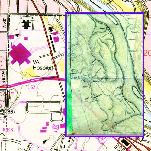
| Below is an overlay of the section of the 1837 Smith map that contains Camp Coldwater with a current USGS map of the area. |
 |