Coldwater Spring Locations over time
Original 1837 locations;
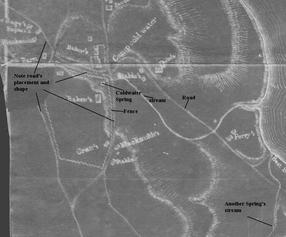
Note Quins is on top of a hill, the spring is in a valley, and Bakers is on top of another hill.
A unique feature of the 1837 map is the inclusion of bluff lines from the spring to the river.
It is also one of the only maps that shows the valley that the water presently flows down
into from the present day reservoir. So what is the square shown for the spring, right next
to the road?
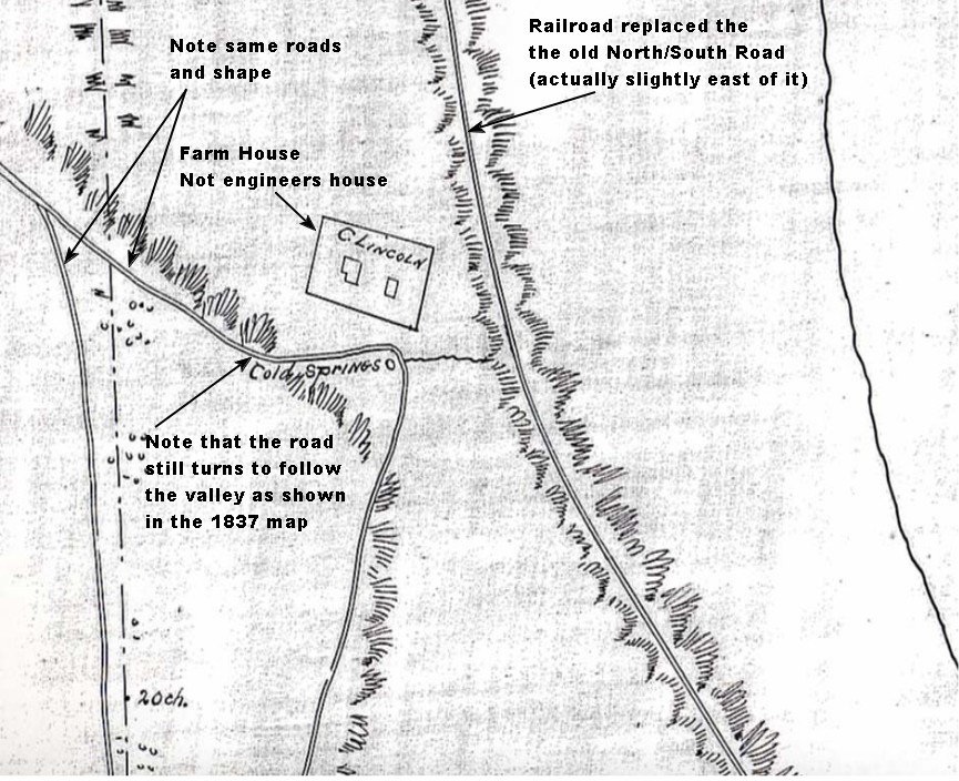
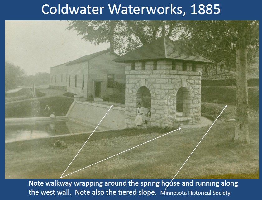
JUST PRIOR TO WATERWORKS CONSTRUCTION
Lincoln Farmstead 1870;
Note that there is no prominate reservoir as of 1870
A December 4, 1879 report by Lt. S.R. Douglas says that:
"The water is obtained from a spring about three quarters mile
from the post, by means of water wagons." This would soon change.
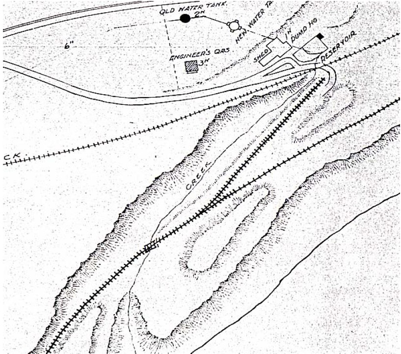
Below is the same area after construction of reservoir and water tower.
(shifted 90 degrees- North is to the right) 1895-1898
The waterworks construction and additional railroad spur, and
then another railroad track dramatically changes the landscape!
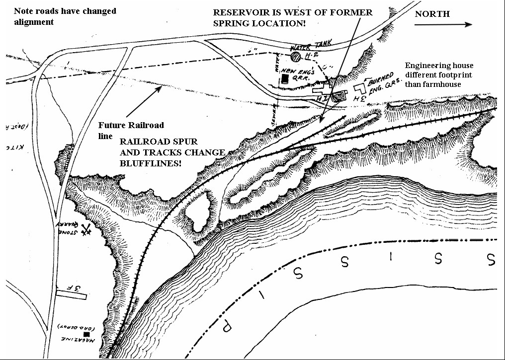
The engineers house and old farmhouse should not be confused.
They are different and in different locations.
So how did the spring litterally move?
First consider a natural spring- how it sits and comes out of the ground.
Below is an undisturbed spring with snow melted where the water runs out
of the ground;
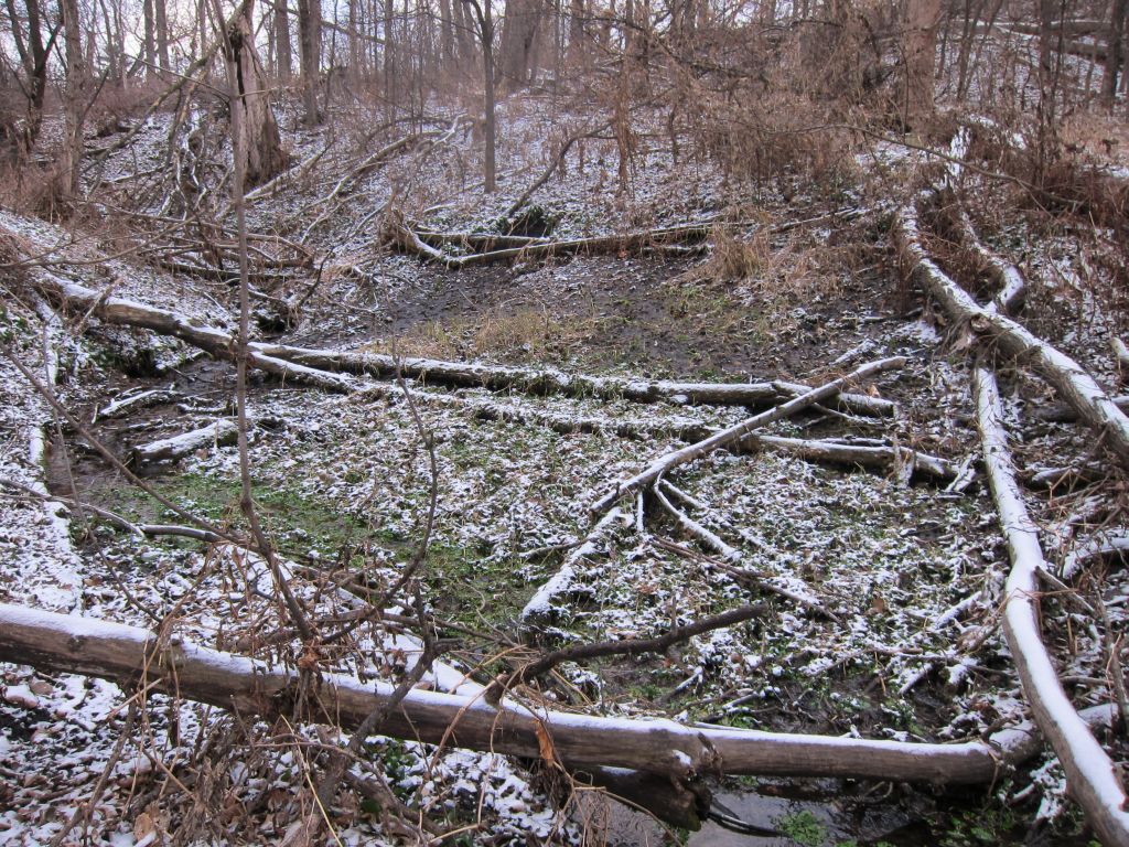
The water comes out of the hill, and then flows downhill.
If the hill is dug back, it is possible to tap the spring at the rock,
not just out of the dirt and sand layers. It also makes room for
a reservoir possible.
Below is a cross section of Coldwater and the land at the hill.
The blue line is the natural water line and it would have come out
below the hill top (similar to the photo above, except the hill at
Coldwater spring is bigger)
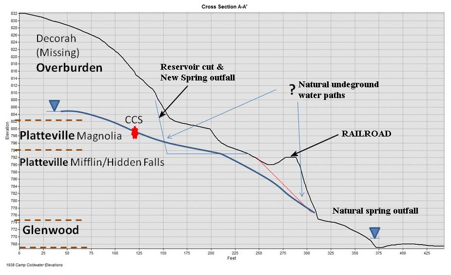
Coldwater reservoir was dug back, the spring tapped at the red dot, and then
the railroad was built infront of the reservoir (and eventually the Bureau of Mines
also placed buildings around it). This shows how the constructed reservoir changed
what would have been dirt and sand laden outflow, into a taped spring.
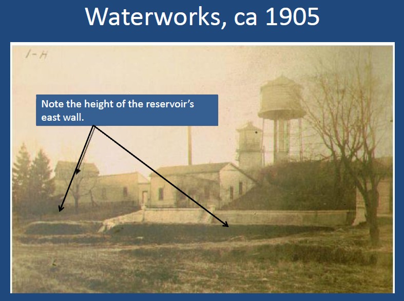
See pictures below;
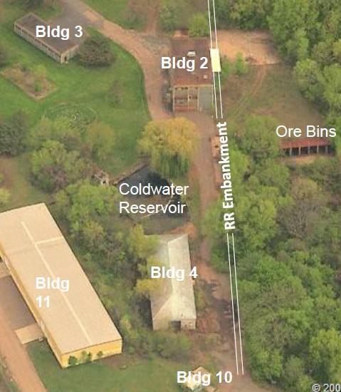
Below is the 1902 waterworks plan with an expanded reservoir
and a second water tower added.
NOTE in the picture above how the hill was further cut back and
the buildings placed on and into the former slope.
The cut was deep enough to require terracing to prevent erosion.
The missing piece in the 1837 map on top of this page should
show the bluff that the water towers sat on, but it was more gradual
then too, prior to the cuts into the hill side for the waterworks.
These maps and pictures shows the area around the reservoir and
springhouse location changed over time. It does not explain the 200
foot shift of the square spring springhouse as shown in the 1837
map and the springhouse that has been in place at the reservoir since 1880.
There have been explanations for this shift, such as the 1837 map isn't that
accurate. But given the extensive layouts of buildings and even the blufflines,
messing up the location of Quins, Bakers and the spring- all within a few hundred
feet of each other, and within sight of each other, is highly unlikely. Especially by a
map maker with the skill to draw the river for well over a mile as accurately
as it is shown!
No- one must explain the small valley that exists below the reservoir,
and the springhouse that is next to the road is at the END of the valley.
This is also BELOW what is known to be the water level of the spring.
A key may be in the 1880 officers report on the construction of the
reservoir and water tower. It lists a trough from the spring.
Considering how many water wagons would be necessary to satisfy
the water needs of the fort, no one would want to lift all that water into
the wagons. Plus with the height differance already existing, there
would be no reason to. It's quite possible that the 1837 springhouse
was more of a filling station to make filling barrels and water wagons
easily done by gravity. Not necessarily the springs actual location.
Return HOME