The Flow Rates of Coldwater Spring changes over time.
The primary reason for this is rainfall.
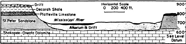
Coldwater aquifer lies solely in the Decorah Shale and Platteville Limestone
layer of rock, well above the water table at the river level. Due to this fact,
it is fully dependant on rainfall to replenish it.
While it may seem alarming to say that Coldwater Spring has a reduced flow now, compared to say the year 2000, when shown against rainfall data, this makes sense, and is NORMAL.
The 55 yearly average rainfall in this area is 27.3 inches. Compare that over the last few years;
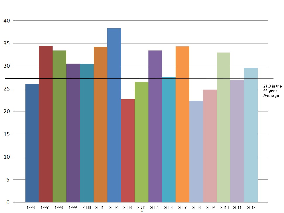
Because monitoring of the flow rate of Coldwater Spring didn’t happen until Highway construction neared in 1998, this period of higher than normal rainfall became the “baseline” data.
During the redesign of the Highway 55/62 interchange, and the liner placed there specifically to protect the water flows to Coldwater, the Minnesota Department of Transportation agreed to use these figures. Not because it was the historical average, but because it was all that was known for actual figures, and the higher than normal rainfall and flow rates provided an added level of protection to the spring.
If the liner was based in higher than normal flows, then it’s slightly over built!
Consider that in October 2003 for example, Coldwater flowed at as little as 45 gallons per minute. In November 2012, it flows at about 60 gallons per minute (counting the same way as in 2003- both the springhouse and creeklet to the south, plus the seeps, which are unfortunatly no longer measured at all. The spring is measured by the NPS only at the springhouse. But if you go to Coldwater and place your hand over the springhouse outflow, note how much water flows from under the steps...this water flow, plus any other seeps that flow into the resivoir are NOT currently measured or recorded. While MnDOT measured the total outflow, NPS only measures the springhouse and creeklet outflow!). This is then further complicated by some rain events, such as in May 2012 there was over 9 inches of rain, but the months of July, August, and September 2012, only recieved 6.6 inches combined. Further, nearby lake levels (which are dammed to keep their levels up) also may play a role in keeping the water table at certin levels.
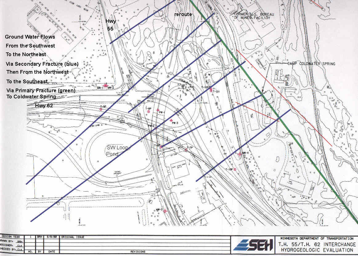
The hydrology of Coldwater goes well beyond the Hwy55/62
interchange and the liner there - designed to save 30% of the flow to Coldwater
Spring.
The 30% figure is a reduction from potentially diverted water, not so much as a
source of water. Coldwater is a gravity fed spring where water simply
flows downhill to the river.
The interchange is built physically lower than the outfall of Coldwater Spring.
Therefore, the drainage ditches had the potential to drain water away from the spring. That is where the 30% figure comes from- it could divert 30% of the flow from the spring outlet to the new lower drainage ditch.
So the liner under the 55/62 interchange isolated it from the water- so the water has to continue to flow out of it’s current location at Coldwater Spring.
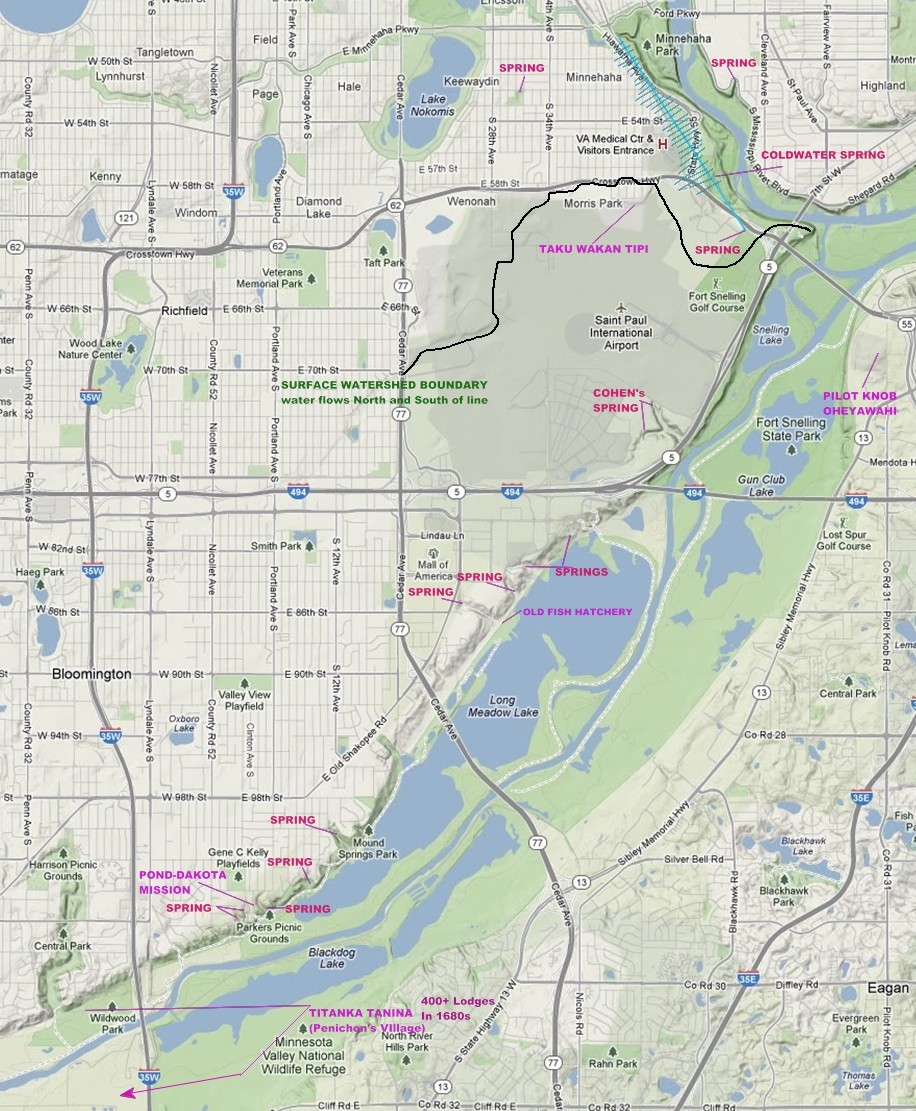
Coldwater Spring has had major construction around it, altering not only the land, but the spring itself. Click here for further info!